Research
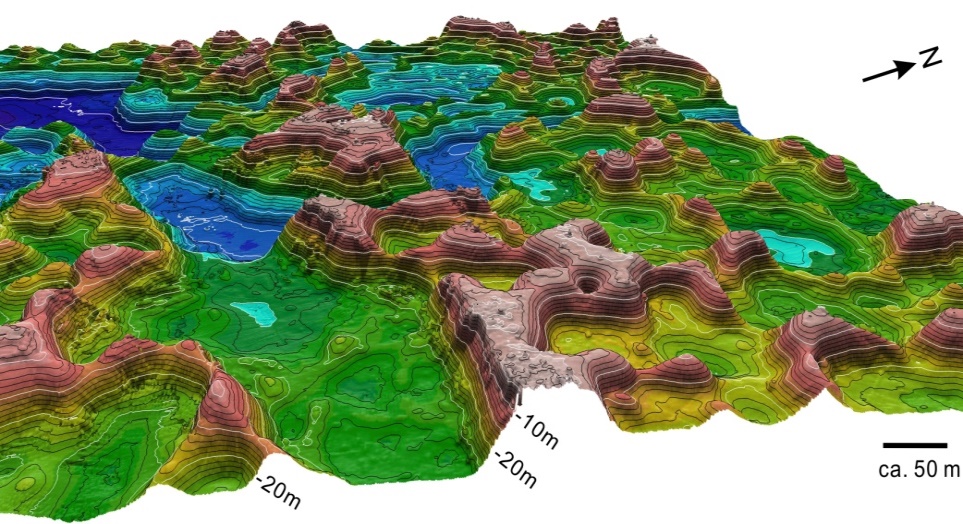
High-resolution multi-beam bathymetric survey for coastal seafloor geomorphology
Scientific knowledge of the coastal seafloor is limited. Therefore, we are pursuing geomorphology and related interdisciplinary sciences on the coastal zones by observing high-resolution seafloor bathymetric maps using a multibeam echosounder R2 Sonic 2022 that I introduced to our laboratory. We have made many discoveries in the coral reef areas in the Ryukyu Islands, and we expect to find more in our ongoing research.
- Open Access Paper in Geomorphology (Elsevier)
- Poster presented at AGU 2014 (JEBCO Science Day document)
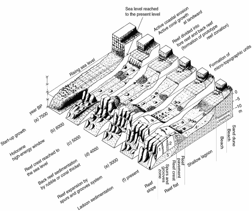
Geomorphology and development of coral reefs
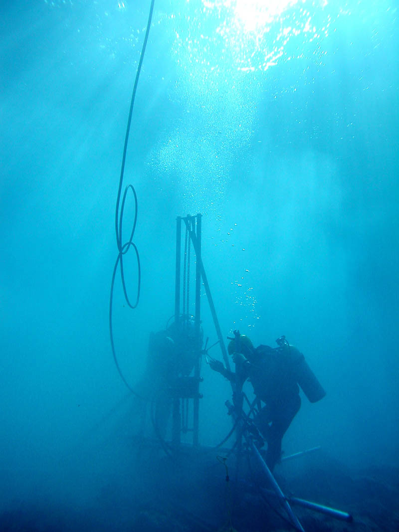
Coral reefs are dynamic geomorphological systems formed by corals and other reef building organisms. These organisms deposit solid limestone and build up wave-resistant structure. We are studying the geomorphology and development of coral reefs using cores obtained from submersible hydraulic drills or through observation and sampling from harbor excavation in reefs.
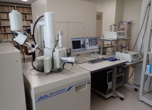
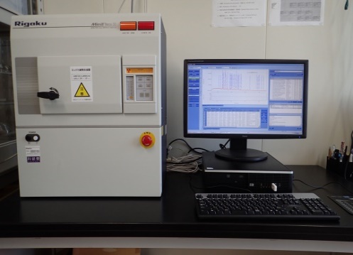
Observation and analysis using SEM-EDS and XRD
We are examining rock and sediment samples using scanning electron microscope energy-dispersive X-ray spectrometer (JEOL JSM-6390L variable pressure SEM with a JEOL JED-2300 EDS). X-ray diffraction analyses are conducted with a Rigaku Miniflex II X-ray diffractometer to determine the mineralogy of the samples.
Reef development, geomorphology and hazards in the Pacific and Indian Ocean atolls
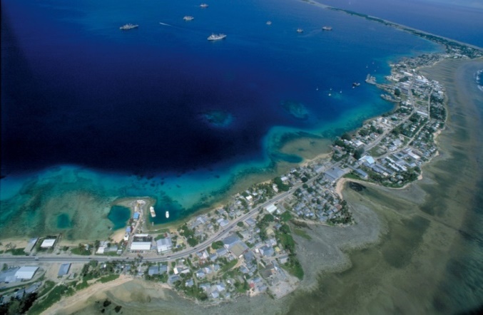
Atoll nations are established on cays on coral atolls in the Pacific and Indian Ocean. We conducted field surveys in atoll nations for reef and island geomorphology, reef growth and disasters in the Republic of Marshall Islands, Kiribati, Tuvalu and Maldives.
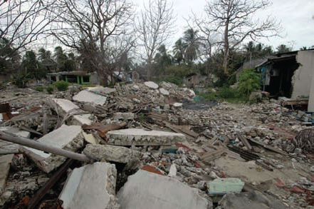
All atoll nations/districts in the Pacific and Indian Oceans face a potential risk of severe tsunami-induced damage. After the 2004 Indian Ocean Tsunami, we investigated 43 islands in the northern-to-southern Maldives by measuring watermarks and profiles across the islands, and interviewing local residents to determine the characteristics of the tsunami and evacuation procedures.
I hope that the information on the December 2004 tsunami events and disaster measures in Maldives will contribute to a better understanding of the risks faced by atoll nations, as well as to developing risk management strategies.